 Litcham Street was coded by Charles Booth, the Victorian reformist, as ‘Very poor’- dark blue on his poverty map of 1898. He described “houses with broken windows, most doors open, untidy and dirty rather than ragged children”, and reported that the street had “a rough drinking and fighting reputation”. Memories of an old Kentish Town resident were recorded by Gillian Tindall in The Field Beneath: “a filthy street, pavements defiled with rheum….several families in one house- one hundred people living in accommodation intended for tens. Two houses were run as common doss houses at which vagrant could sleep….and from the windows not a few ravaged faces looked down on upon you from between frosty cobwebs of curtains.”
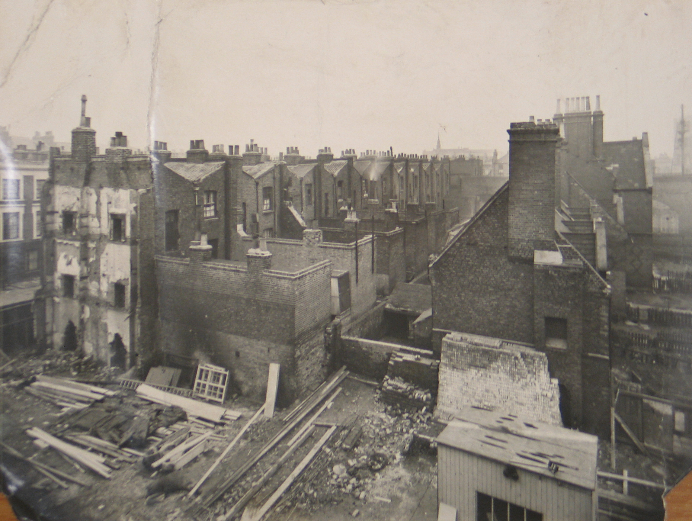
 Litcham Street before the construction of Ashington (image courtesy of London Borough of Camden)
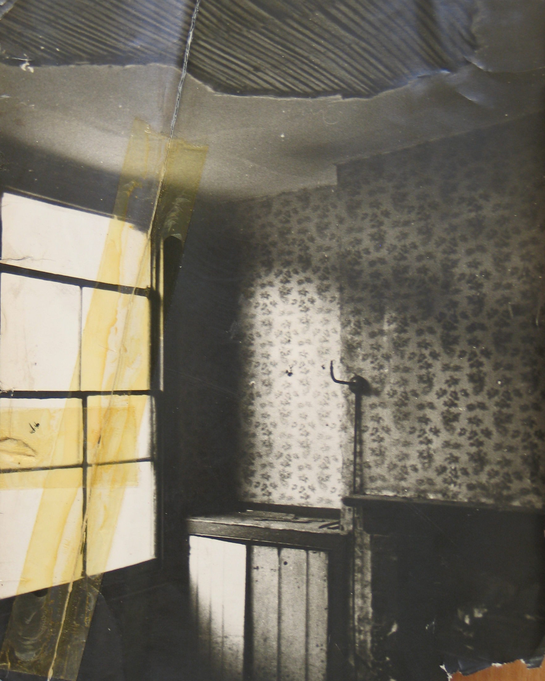
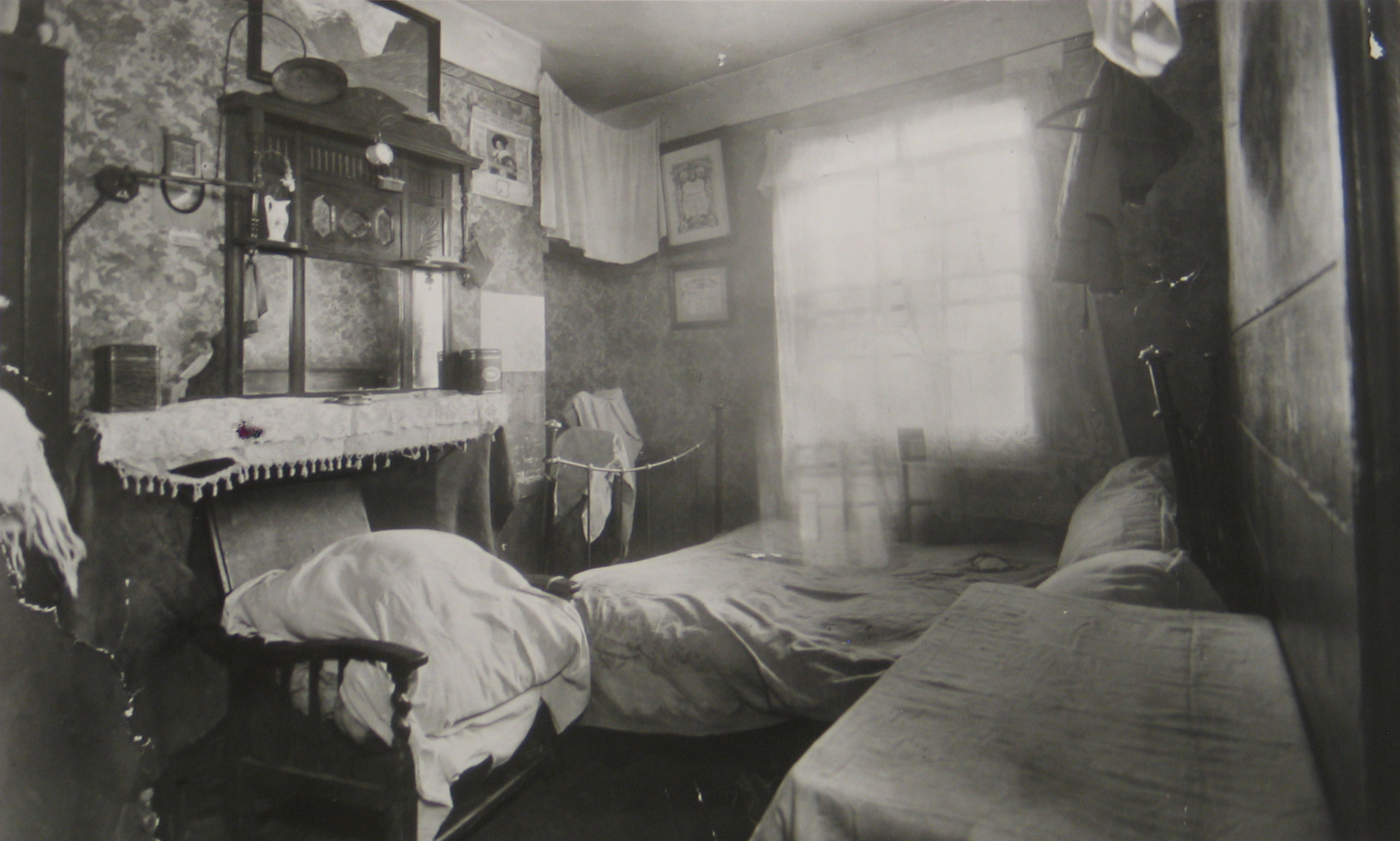 Litcham Street interiors early 1930s (images courtesy of London Borough of Camden)
 A booklet published by St Pancras House Improvement Society in 1931 describes a house of 12 rooms where eight families were living. The Society had been formed in Somers Town in 1924, but also turned its attention to Kentish Town. The conditions in Litcham Street provided the impetus to commence fund raising for the replacement of the existing houses with modern flats.
Much of the fundraising took place in Hampstead including a garden party attended by 3,000 people, and a celebrity cricket match led by JB Priestley. During the 1930’s Priestley became very concerned about the consequences of social inequality in Britain, and in 1942 helped set up a new political party, the Common Wealth Party, which argued for public ownership of land, greater democracy, and a new ‘morality’ in politics.
The first block of the Athlone Estate was completed in in 1933, and all four blocks were completed by 1937; Litcham Street was subsequently renamed Athlone Street.
 Athlone House under construction (image courtesy of London Borough of Camden): “Litcham Street back yards, rat ridden and congested- we have since built Sherborne Nursery School here.“
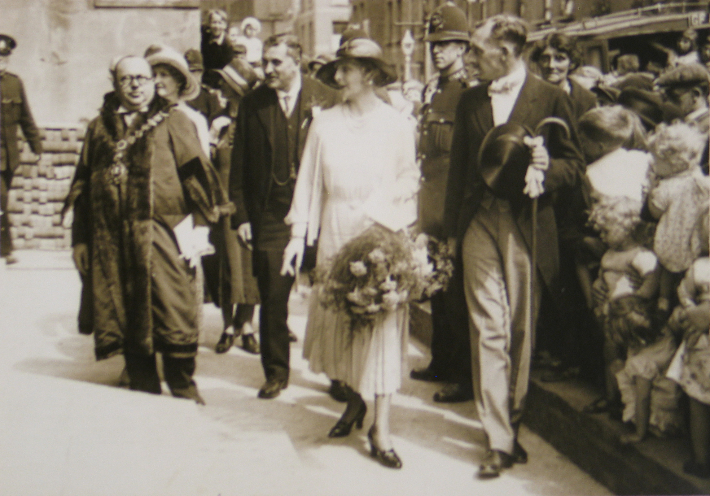 Princess Alice opens Athlone House, 1933 (image courtesy of London Borough of Camden)
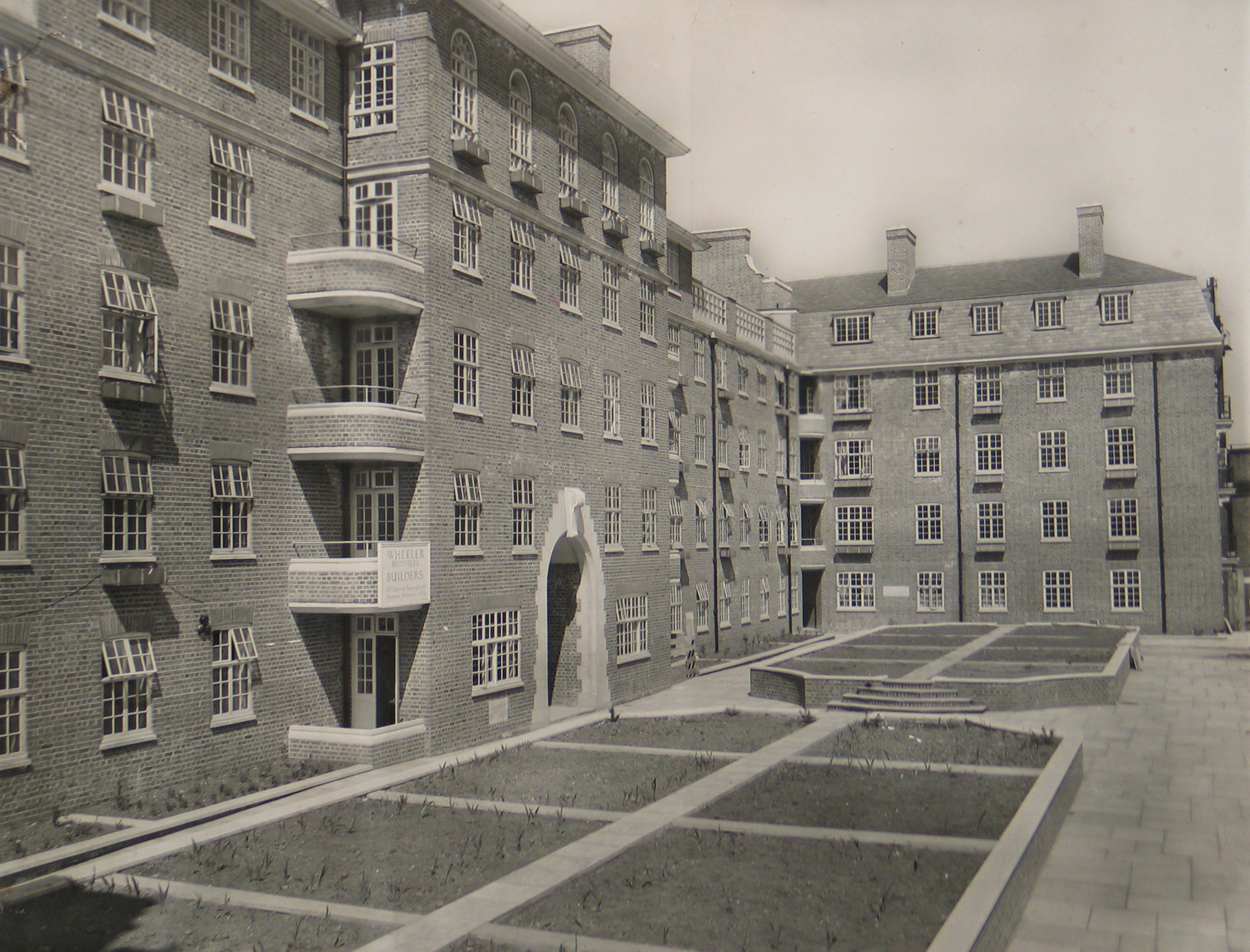 South aspect of 49 flats Leonard Day House and Priestley House with Sherborne Nursery School on the roof (image courtesy of London Borough of Camden): “note glazed concrete screens to the Nursery School roof gardens- also tenants’ gardens below. When the photo was taken tenants had not yet moved in. Now nearly all gardens are full of flowers.”
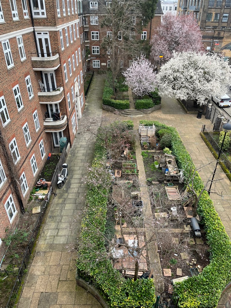
The communal gardens today
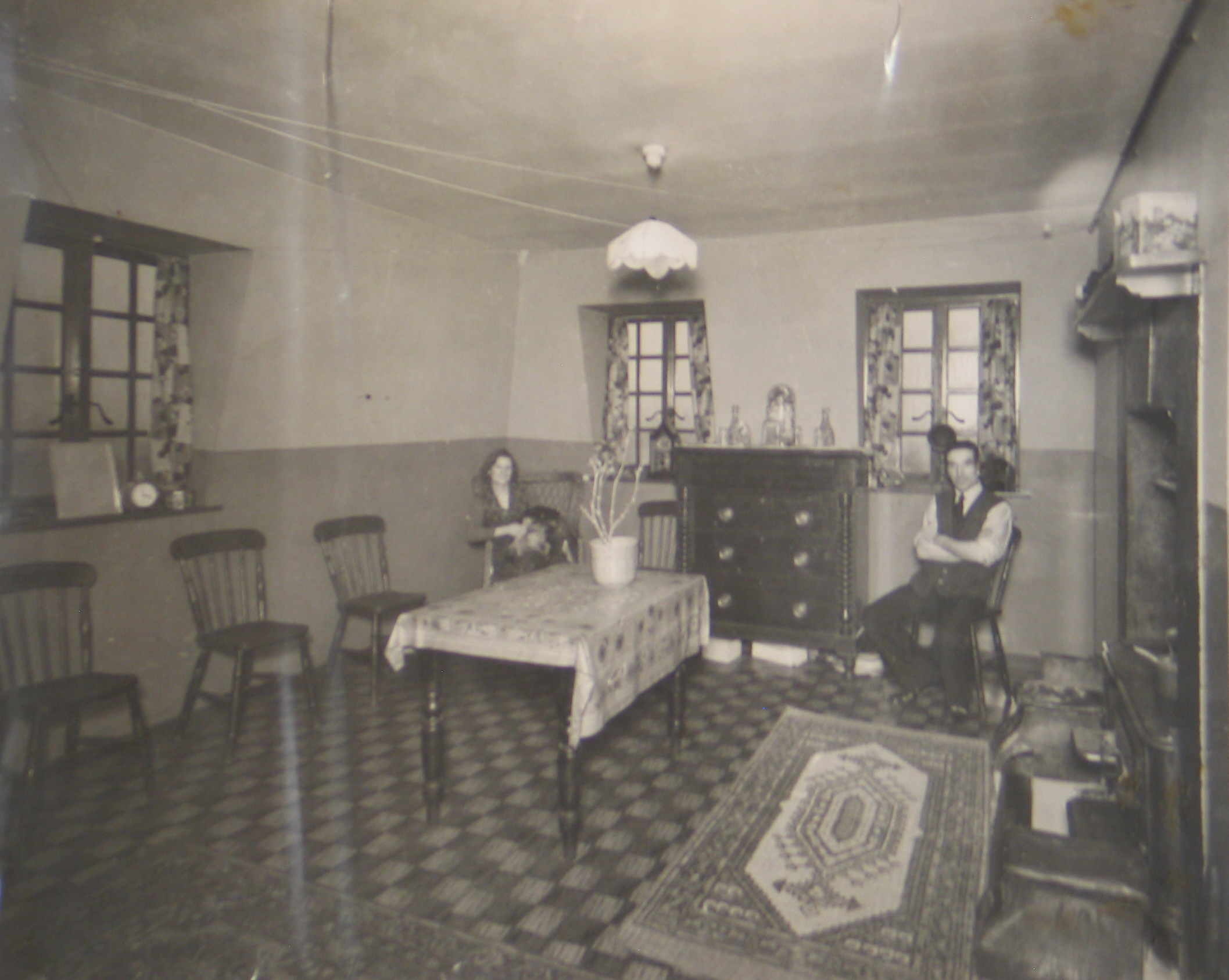 A flat in Athlone House (image courtesy of London Borough of Camden): “the living room of a 4 room electric flat.”
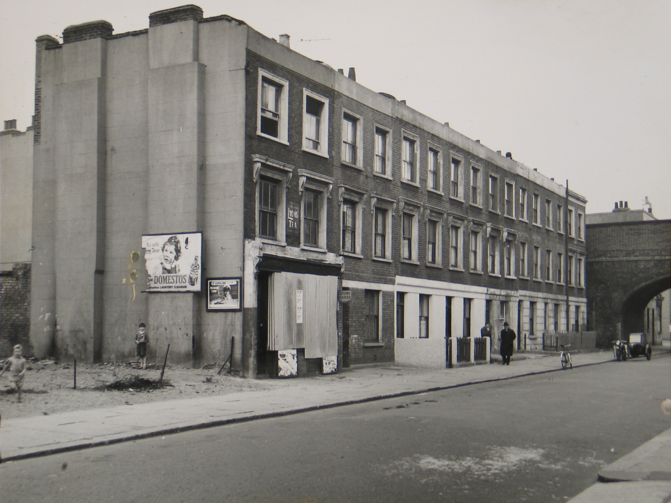
 Back of Litcham Street with Wilkin Street on the right, 1936 (image courtesy of London Borough of Camden): the site of Leonard Day House and Priestley House
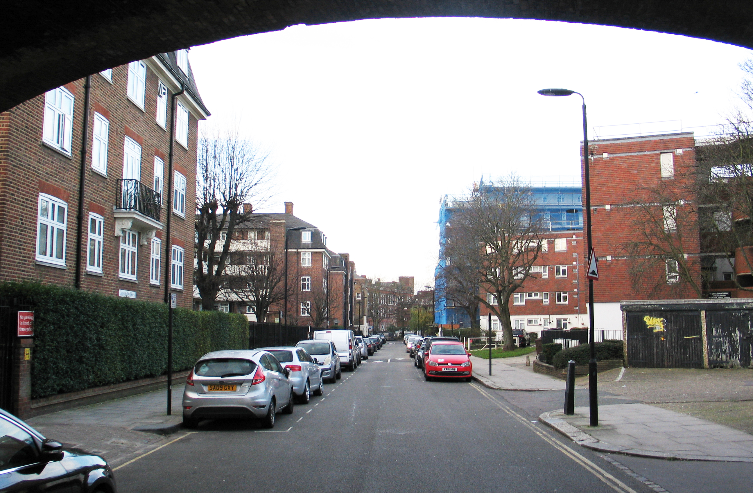
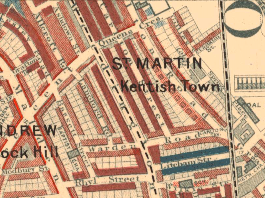
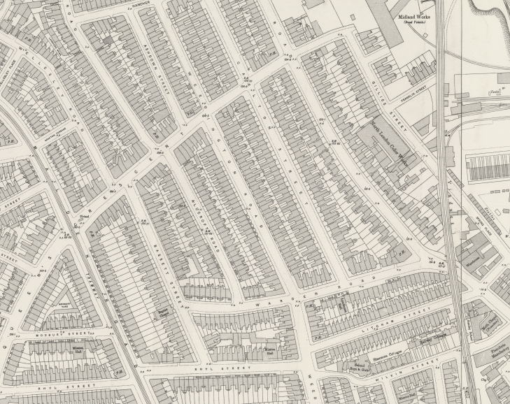
Why was Litcham Street so bad that it became a ‘slum pocket’? When west Kentish Town was built between 1850- 65- by multiple small scale developers- the intention was that these houses would be let to the rising middle classes. However, although the streets are wide with the impression of a generously planned layout, the houses themselves back onto each other with very little space between, resulting in a lack of daylight and air, and unsanitary conditions. This can be seen in the old OS map below: the backs of the houses in adjacent streets are barely a few feet apart. Another factor in the decline of Litcham Street is its immediate proximity of the railway viaduct. The blight of the railways on west Kentish Town has been highlighted previously: the noise and pollution from passing steam trains would have been considerable.
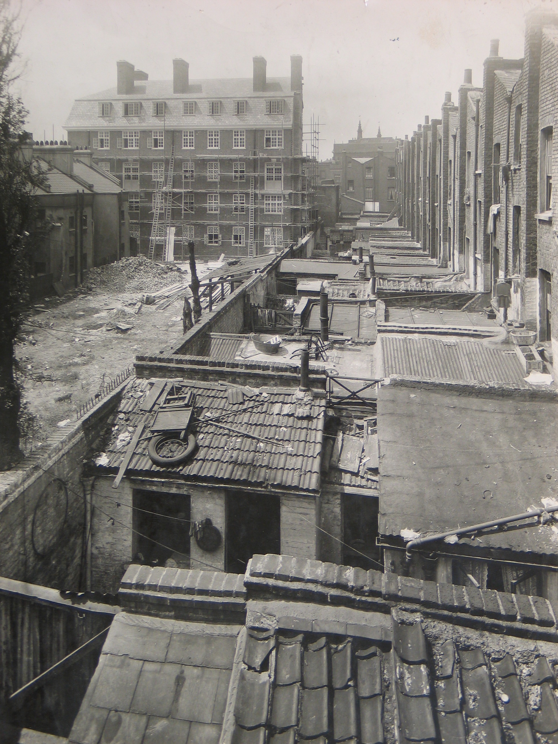
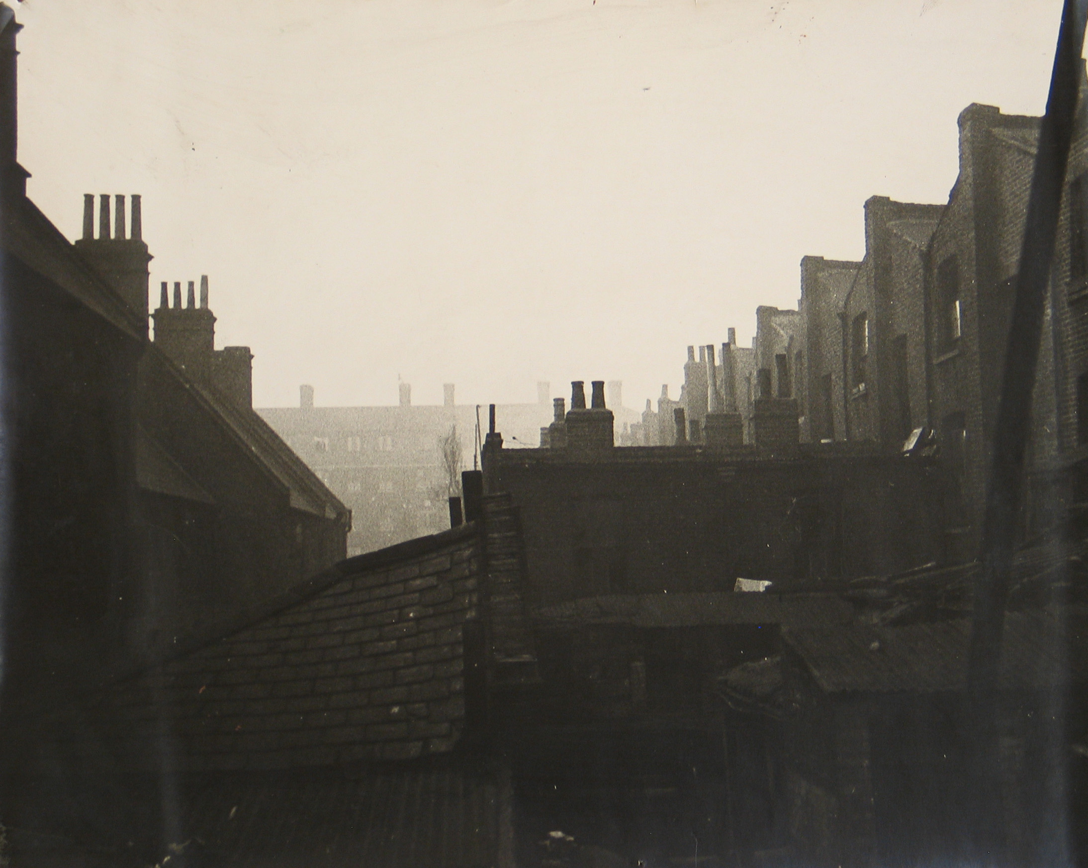 Back of Litcham Street (image courtesy of London Borough of Camden)
Another street blighted by the cramped conditions of the houses is Carlton Street, running south from Queen’s Crescent. Early Carlton Street was respectable enough: two private academies were located there in 1862, but by Charles Booth’s survey of 1898, it was rated only as ‘mixed. Some comfortable others poor’ (coloured purple on the map above).
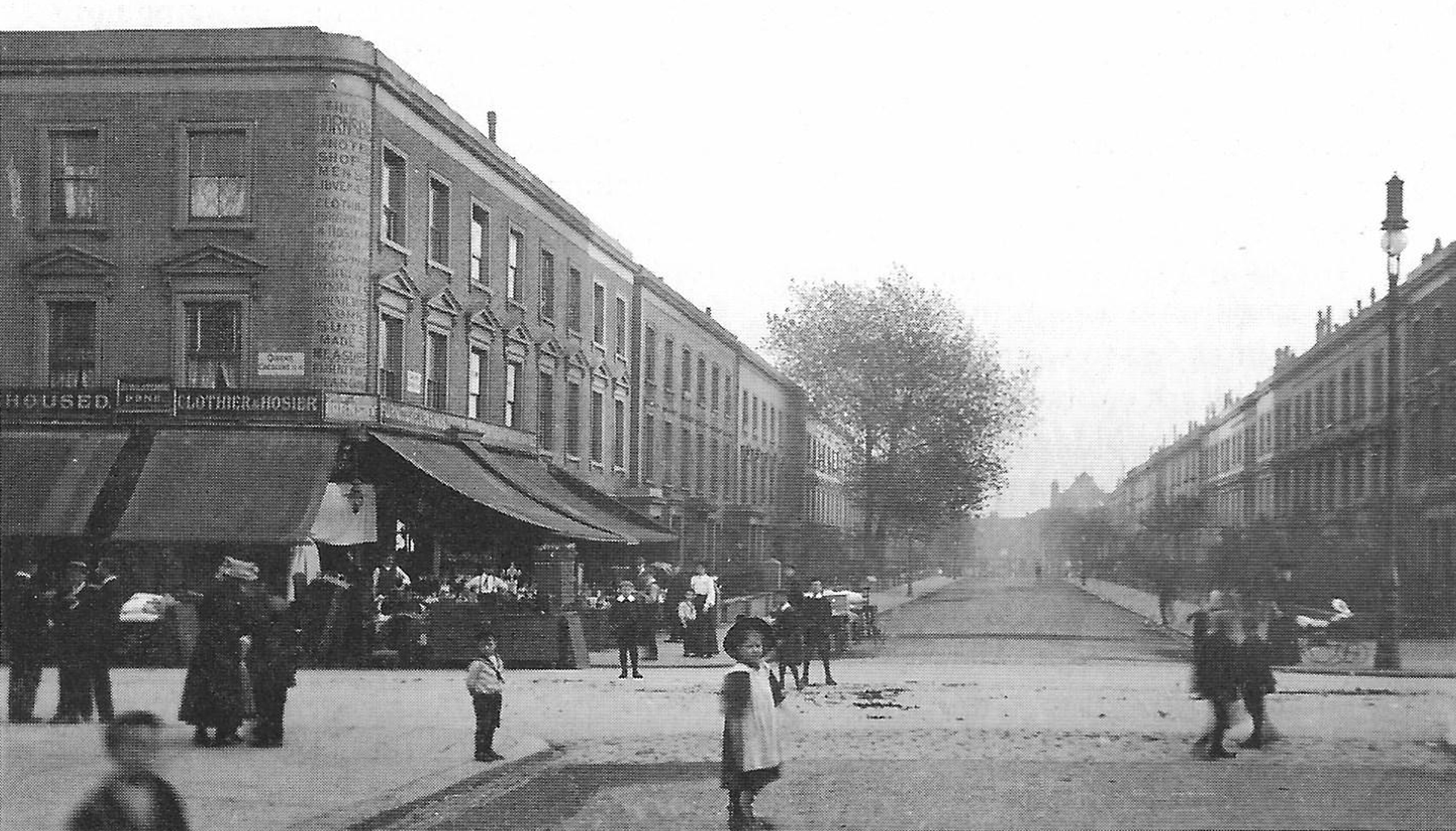 Carlton Street at junction with Queen’s Crescent
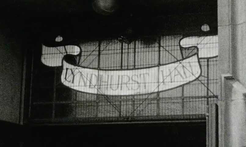
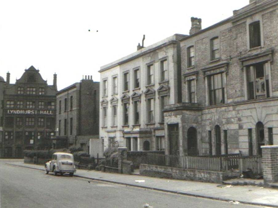 Carlton Street, looking south to Lyndhurst Hall on Warden Road
Lyndhurst Hall as once a major focus of local community life in the area. Built as a mission hall by Hampstead’s Lyndhurst Road Congregational Church in 1891, it was a resource for local people at a time of general poverty. It hosted a range of events, including clubs for boys, girls, men and women, bible classes and Sunday services, as well as entertainment and legal and financial advice. During the 1950s, community activities at the hall included the Boys Brigade, Sunday schools, youth club and children’s nursery. Lyndhurst Road Congregational Church sold the building to St Pancras Borough Council in 1963 and it reopened as a community centre two years later. It was available for hire for private functions and was also home of St Pancras Amateur Boxing Club. In the mid-1980s most of the ground floor was used by the Camden Workers Social Club. The Men’s Institute, a nursery and a pensioners’ club continued to flourish until the 1990s, when the hall was closed, deemed as underused by Camden Council. It was subsequently sold to Notting Hill Housing Trust, who demolished the existing building and redeveloped the site. The social space for the area that was provided by Lyndhurst Hall has not yet been replaced.
The long linear blocks between Allcroft Road and Grafton Road that run north-south between Queen’s Crescent and Warden Road fostered slum conditions due to their poor planning. They were the first in the area to be demolished and redeveloped by St Pancras Borough Council. West Kentish Town estate prioritised light and air on all sides of the buildings; unfortunately this was at the expense of a legible structure of street and public space. In redeveloping the area for second time, the need for proper planning and adequate distances between dwellings must be considered, as was the case at Athlone Estate. The scale and setting of Athlone Estate should be respected by the new development, and a new community space for the area be provided to replace Lyndhurst Hall.
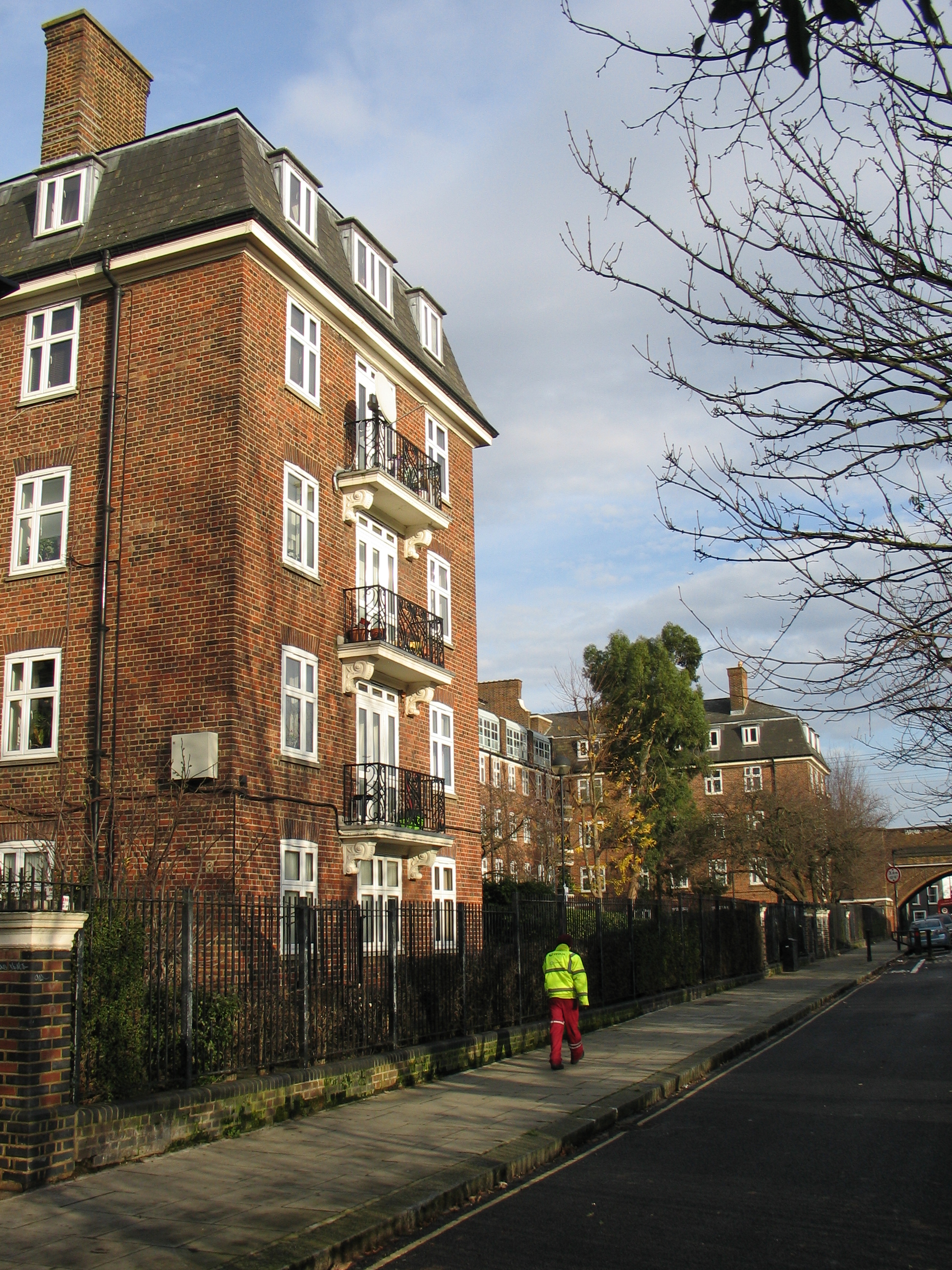 Athlone Estate viewed from Wilkin Street
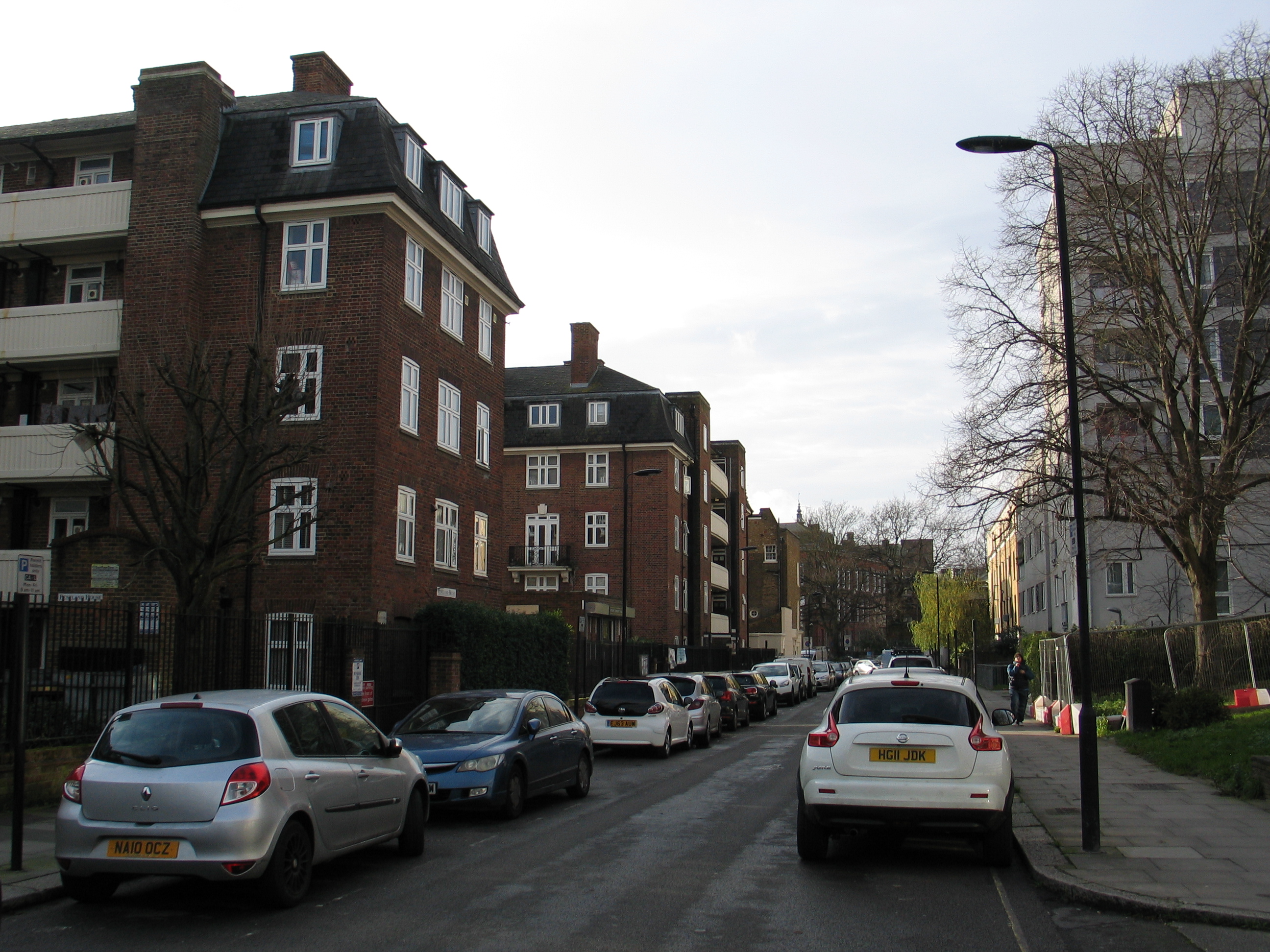 Athlone Estate viewed from Athlone Street, with Rhyl School in the distance
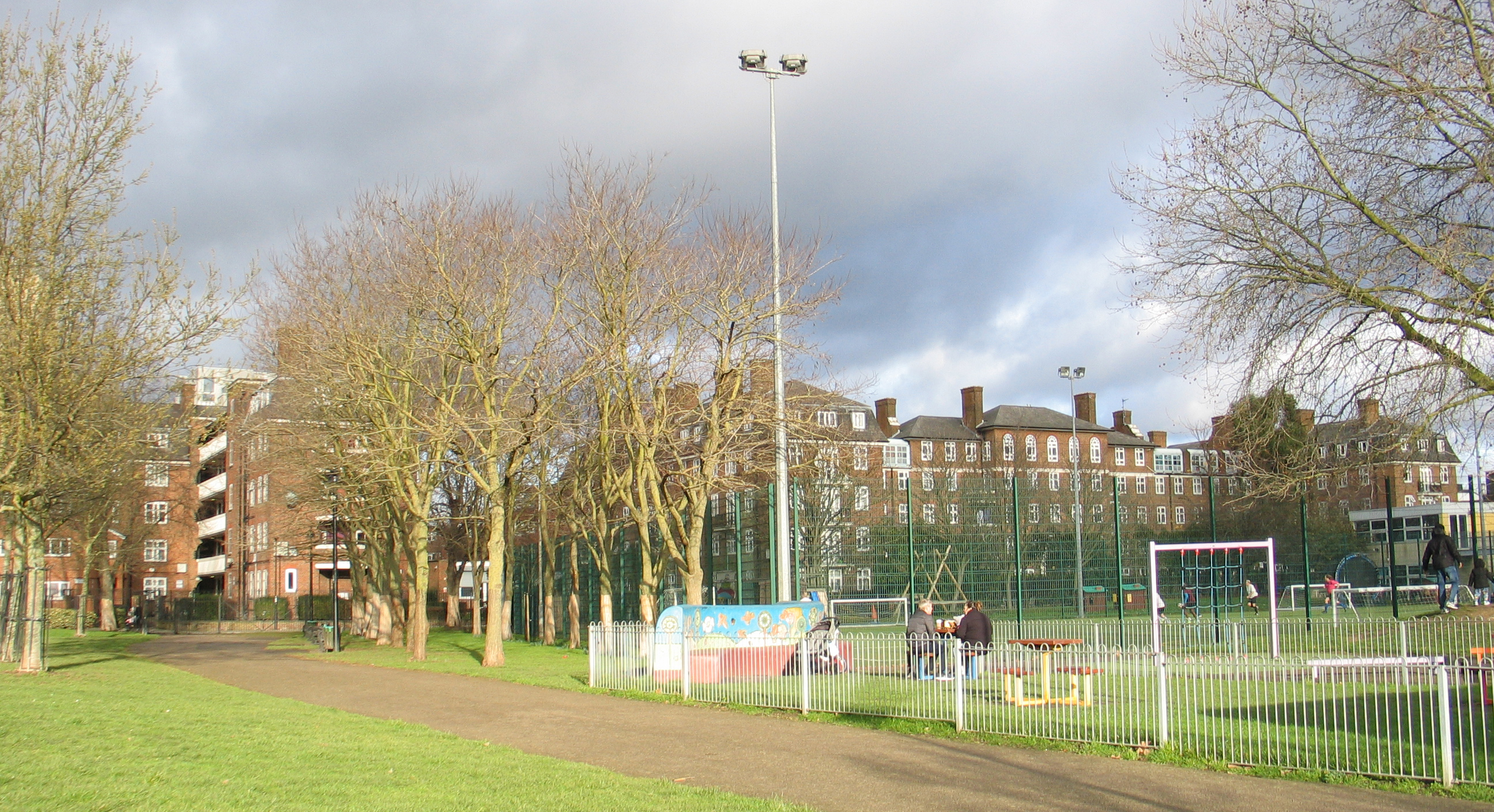 Athlone Estate viewed from Talacre Open Space

I lived in Carltoun Street (Carlton Street),in the early fifties,leaving there when I was six.I only have vague memories,(the Coronation day street party etc.),and would love to see any old photos of the street.I do somewhere have some old photos of the street,but when family members pass on,photos get misappropriated and lost .My Mum was Doris Walker,and we lived in number 30 next door to the Nicholls family
LikeLike
Hello James. Not sure whether you will pick this up but here goes! I was born in Carltoun Street in 1947 and my family lived at number 12. Not one of the posh houses and four families shared the house . I was querying with my sister about number30 was it up towards Queens Crescent or down towards Lyndhurst Hall. We left when the properties were demolished and I was about 12 and my sister about 16. My family name at the time was Cavell. Look forward from hearing from you. hilaryfergusson@hotmail.com
LikeLike
My family lived on Litcham Street and I would love to see more photos please if anyone has any….thank you
LikeLike
JOHN FURNELL
Lived in Athlone Street until 1959 Aged Six. The Photo of a Young boy about to run across the road
is me i believe running after a ball playing cricket. Our House in the Photo was ground floor 1ST
white house with gate / fence of which my father done. In 1959 Parents built a large fire
celebrating 5th November on the Debri of demolished houses. The fire brigade attended due to
the extent of the fire. Me and my brother joe are planning to do a tour of the area in July.
LikeLike